


By Ken Kurtulik
This September, Rutgers welcomed thirteen masters’ and Ph.D. students into a new program that is working to help coastal communities and ecosystems become more resilient to the effects of a changing climate.
“The Coastal Climate Risk and Resilience, or C2R2, program trains students from many disciplines to collaborate and to work with the stakeholders on the ground,” said Carrie Ferraro, associate director of the program. Students in the Earth system sciences, civil engineering, human geography, and planning and public policy are presently enrolled. In the future, the program would also like to attract students for other disciplines, including public health and business students.
“Three-hundred eighty million people currently live within 21 feet of the high-tide line, and communities are building ever closer to the beach,” Ferraro said. This puts them at risk from coastal flooding, especially in the face of rising seas and a changing climate.
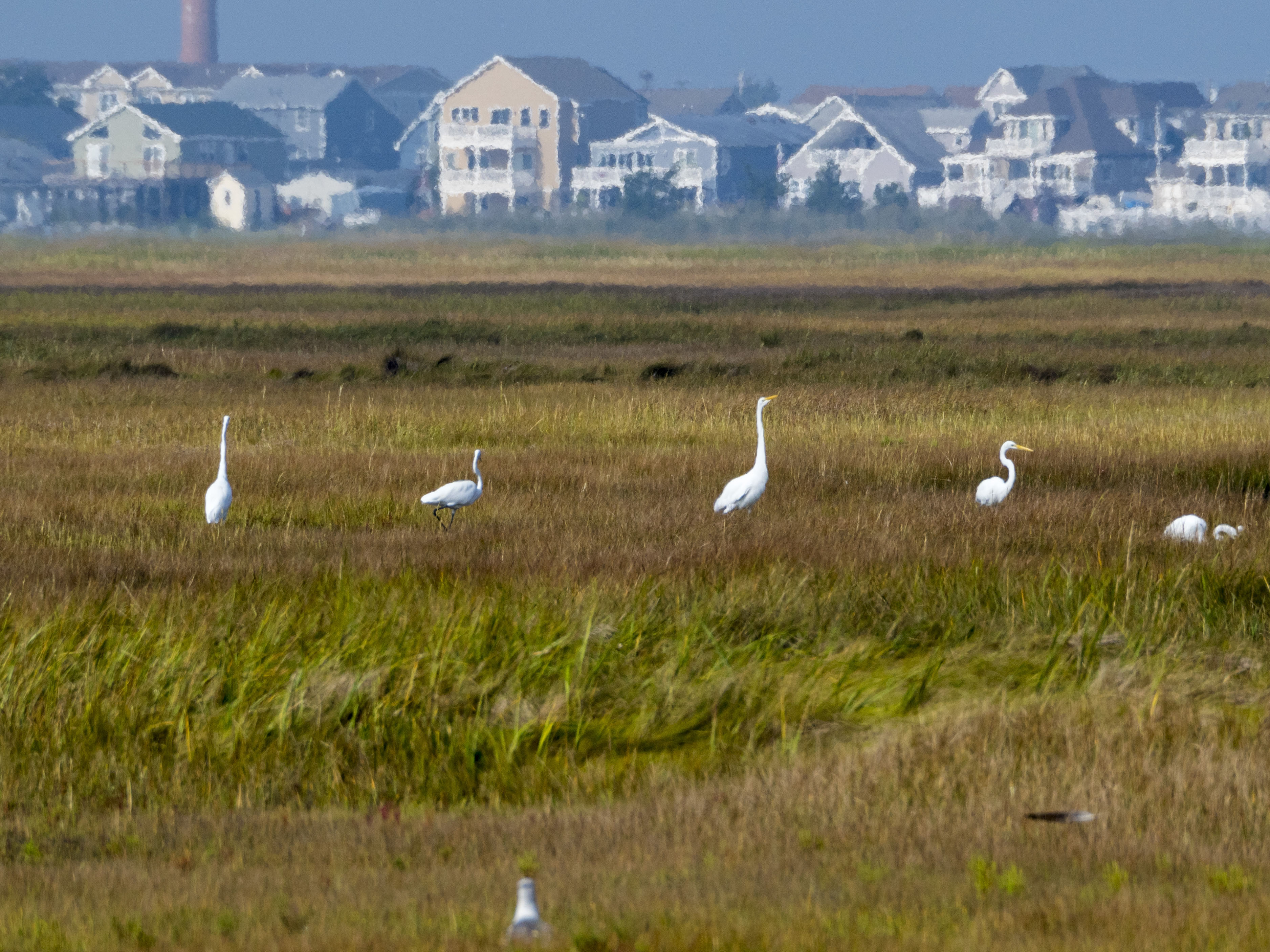
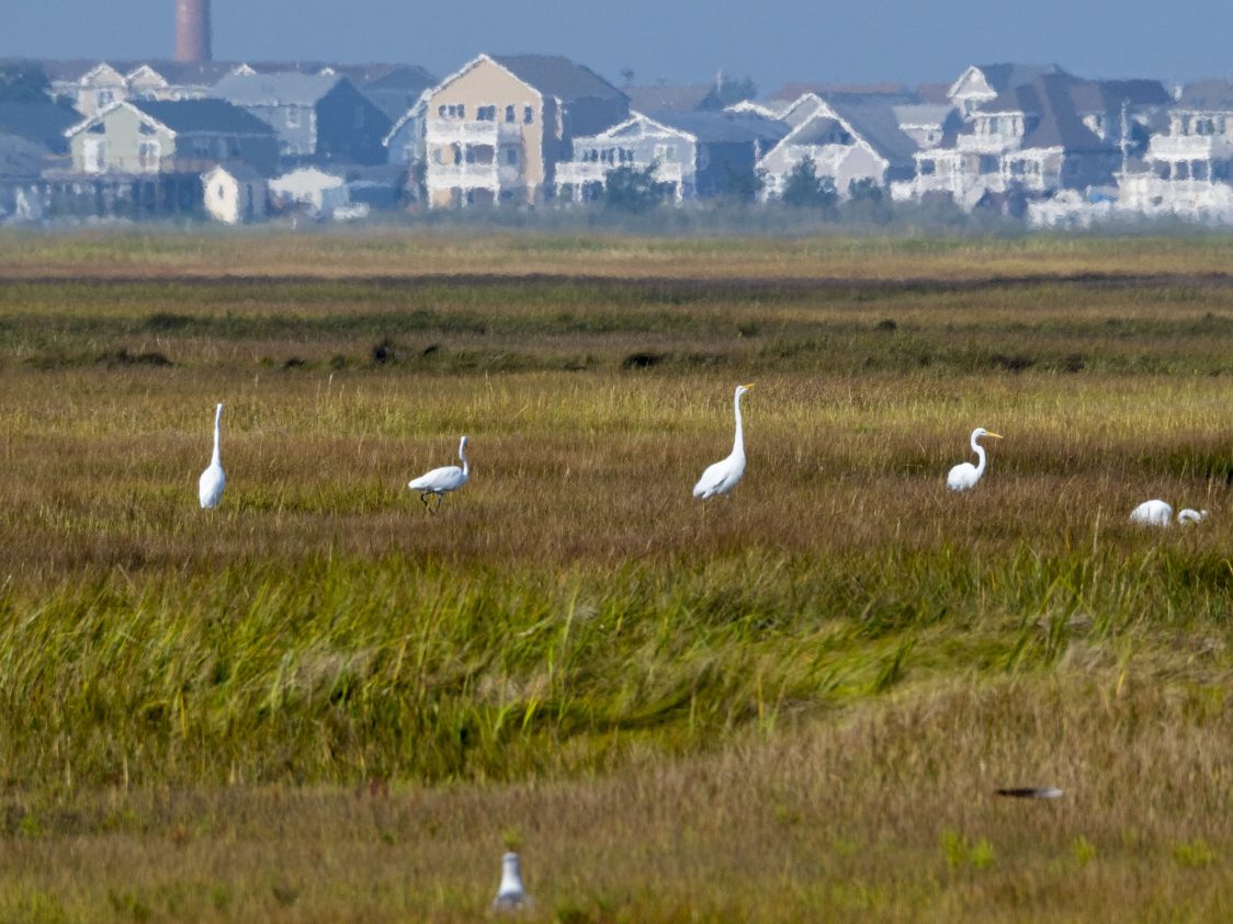
Great Egrets forage in the marshland of Great Bay Boulevard WMA. A Little Egg Harbor Twp neighborhood can been seen in the background. Photo by Matt Drews
Four years ago, as part of the Rutgers-New Brunswick Strategic Planning Process, several dozen faculty began discussing a coastal resilience initiative, said Robert Kopp, director of the Rutgers Institute of Earth, Ocean, and Atmospheric Sciences and co-director of C2R2. After a couple of attempts, they secured funding as part of the National Science Foundation Research Traineeship program, which supports innovative graduate training initiatives. The first five students began in spring 2017.
“Rutgers has a lot of expertise stemming from our strengths in different relevant disciplines and from our location in New Jersey,” Kopp said, “but the problem of understanding and managing the risks that climate change poses to the coast isn’t a disciplinary problem.”
“People must communicate between disciplinary boundaries to address coastal and climate problems,” he said. “If you come out of engineering or oceanography with no background in communicating with people, no background in thinking outside your discipline, you’re not going to be as useful in a team environment or as desirable to future employers.
“I’m interested in bridging the gap between science and policy,” said Zoe Linder-Baptie, a C2R2 student pursuing master’s degrees in urban planning and public policy. “I think it’s really important for students in science-based programs to talk to students in other programs in order to try and bridge that divide while they’re at school, so that when they go out into the working world and are professionals, they have the understanding and respect for that connection and relationship.”
The C2R2 curriculum covers transdisciplinary approaches in coastal climate change risk analysis, communicating science with stakeholders, a studio course on coastal resilience, and electives spanning natural sciences, social sciences, and engineering.
“Good communication skills are essential for people in leadership roles,” said Lisa Auermuller, assistant manager at the Jacques Cousteau National Estuarine Research Reserve (JC NERR).
To understand how science informs decision making, students must first learn how to address people with differing perspectives. Auermuller is one of the instructors in the communications course, which teaches students to communicate complex topics, work with stakeholders, collaborate with partners, and write science succinctly for a lay audience.
Auermuller also leads a 10-day field course over the summer, during which students are housed in Tuckerton, New Jersey. Students travel around the state to learn about resilience issues affecting the area and work with the local government, nonprofits and corporations.
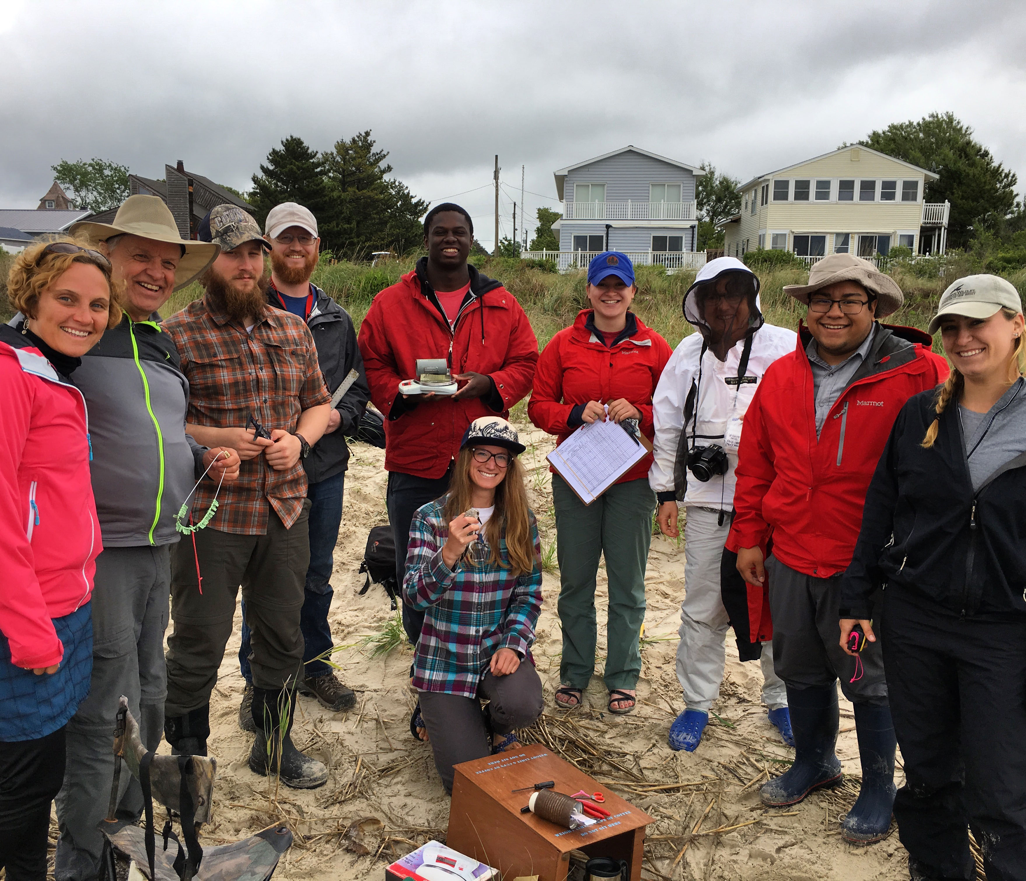
C2R2 students work with members of The Nature Conservancy on bird banding and marsh restoration
“Rutgers helps local municipalities develop resilience plans as part of JC NERR’s ‘Getting to Resilience’ program,” she said. These plans access the risk and vulnerability of coastal hazards, explore how well-informed citizens are, ensure hazard plans reference one another, develop a strategy for disaster recovery, and mitigate future hazards by learning from past storms.
“The field course is a really great way to start the summer,” Auermuller added. Students first learn about the resilience challenges on the ground, then they apply that context to their own projects.
The partners involved include PSE&G, the Army Corps of Engineers, The Nature Conservancy, which explores nature based solutions, and the Ironbound Community Corporation, which investigates resilience challenges to socioeconomically vulnerable urban populations.
On the last day of the course, students are asked to make recommendations on what current resilience planning guidelines are missing. “This summer, students identified a need for more nature-based solutions and more short-term emergency response, and suggested local businesses should be incorporated in the plan,” Auermuller said.
The studio course, offered in the fall semester of students’ second year, is a workshop that assesses risks posed by climate change to a client coastal community. Though the class is rooted in urban planning, the course incorporates experts from many fields. The topics discussed include sea level rise, municipal finances, geographic analysis, and public engagement.
The studio is working in Union Beach this year, said Clinton Andrews, a professor at the Bloustein School of Planning and Public Policy and instructor for the studio course.
Union Beach was badly damaged by Hurricane Sandy. After five years of recovery, many buildings remain abandoned. To prepare the community to deal with future flooding events, the Army Corps plans to add sand to beaches and build dykes, berms, bulkheads and sluice gates. “It is presently unclear whether the construction will begin next month or at all,” Andrews noted.
The Army Corps plan, likely to cost hundreds of millions of dollars, will drastically alter the risk profile of Union Beach. The studio class is assessing how likely this and other plans are to come to fruition. Considering existing plans, public engagement, geographical concerns and hazard profiles, the class is testing how robust competing strategies are against different hazard scenarios. Students will then be able to make risk resilience recommendations to the municipal government.
To accomplish this task, the course is divided in three sections. First, the class learns about the Union Beach community and identifies what questions need to be addressed. Then, the class investigates the flood plain using Geographic Information Systems (GIS). Finally, students will present their findings on coastal resilience to the Union Beach community.
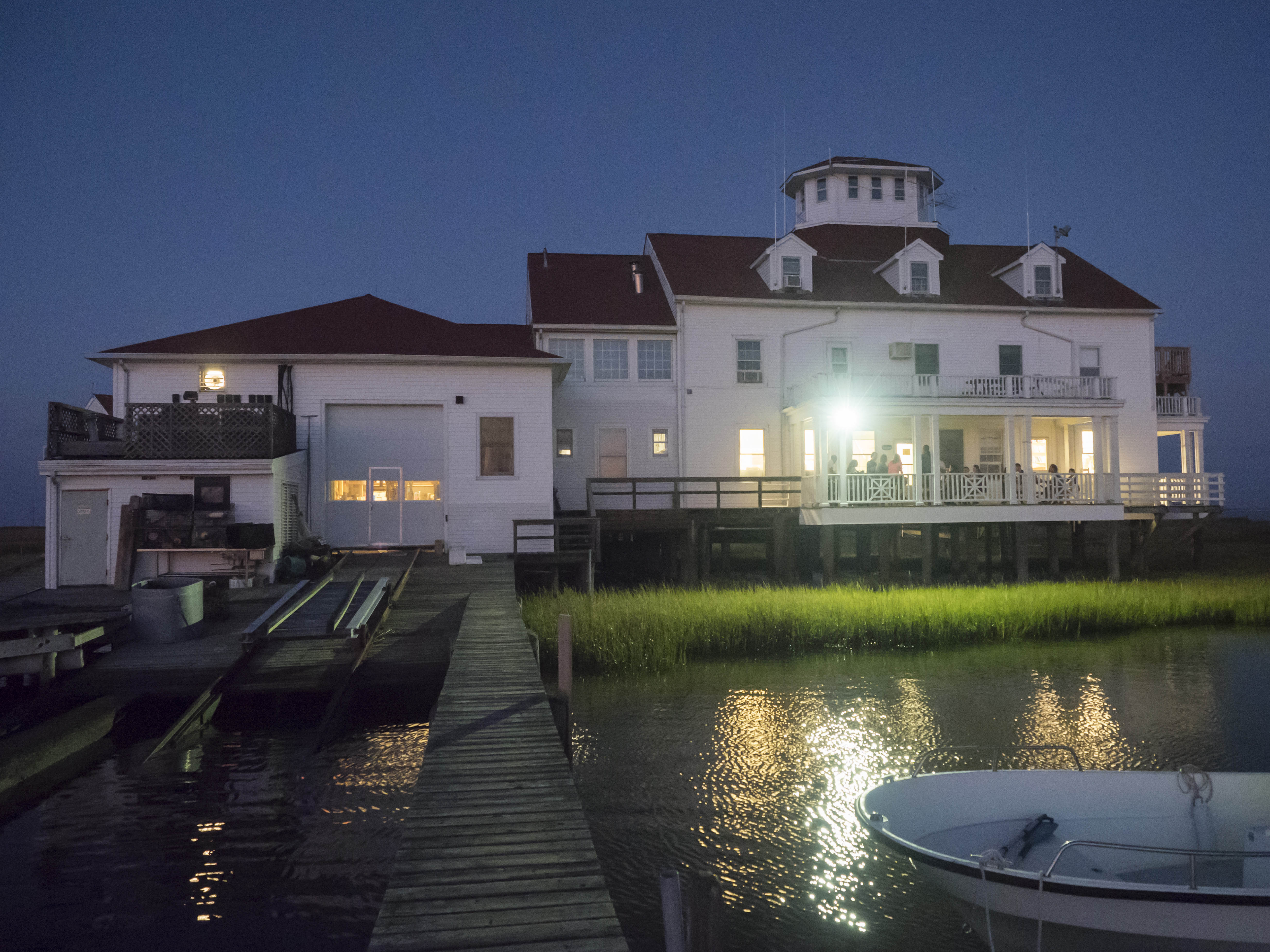
The Rutgers Marine Field Station is an invaluable research lab located in the coastal marshlands of Tuckerton, NJ, home to countless different research projects in virtually all aspects of marine science and coastal resilience. Photo by Matt Drews
“The studio class met with the Union Beach mayor, town planner and town administrator before touring the sites marked for redevelopment,” said Linder-Baptie, who is taking the course this semester. Participating in a community cleanup day and attending Union Beach Day, a town fair, helped the class understand the community’s values, she said.
In the coming weeks, students will lead a focus group to learn more about the community. The study will assess what the town’s values and problems are, how Hurricane Sandy affected the community, and how residents envision the town’s future.
Back in the classroom, students are researching flood damage by reviewing census and Hazus map data. Census data defines the occupations, income, and demographics of community residents. Hazus software projects the damage and financial loss a community can endure following a storm event.
The software estimates the extent of flooding due to storm surge, property damage as a percentage of property value and income loss due to power loss or displacement.
While this analysis happens, another group will analyze the town’s existing land use, redevelopment plans, and the US Army Corps of Engineers’ plan.
C2R2, funded by a grant from the National Science Foundation is managed by the Rutgers Institute of Earth, Ocean, and Atmospheric Sciences, in cooperation with the Bloustein School of Planning and Public Policy and the School of Engineering.